
|
Point du Hoc
|
Sites and places
Point du Hoc
During the preparation for "D-day" (aka Operation Overlord) a German site was identified right in the proposed American sector that could fire upon two (Utah & Omaha) of the three American landing beaches.
This site was "Point du Hoc" and it could fire it's six 155mm guns over 25km to any invading force , causing massive damage. To counter this threat the site was bombarded with waves and waves of bombers and later, on d-day itself with several warships. The Battleship "Texas" fired 600 salvos of 356mm shells on Point du Hoc alone!
Following up this preparation an incredible feat was accomplished; an American Ranger force 225 man strong stormed the cliffs with landing craft, climbed up the steep cliffs with ladders and ropes and assaulted the German garrison to destroy the German guns (only to find out they had been replaced by telephone poles - the real guns were found and destroyed in nearby woods by the rangers where they had been hidden to save them from bombardment!).
In the end the Rangers fought of five German counterattacks before other allied troops reached them over land, suffering 70% cassulties.
More history can be found at the military history online site.
This site is very impressing, I could visit it only for a short while, being unable to take the tour but still it leaves quite an impression. How anyone (or anything) could have lived through the massive naval/air bombardments is still a mystery to me.
Note the site does note really overlook the Omaha or Utah beech at all as several books state - another "point" (cliff) is in the way on both sides , but certainly the guns could have fired on the beaches if they would have been mounted in their bunkers.
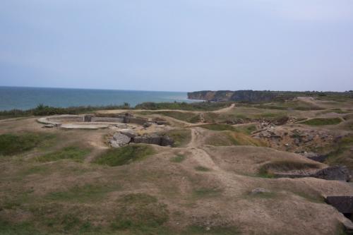
Point du Hoc in 2003 (facing east/north east) note that no beach is directly visible. The terrain has not been touched since 1944, conserving it as a monument.
Point du Hoc in 1944 after allied landings. After the war the entire site had been granted to the USA by France as a gift to remember the fallen soldiers.
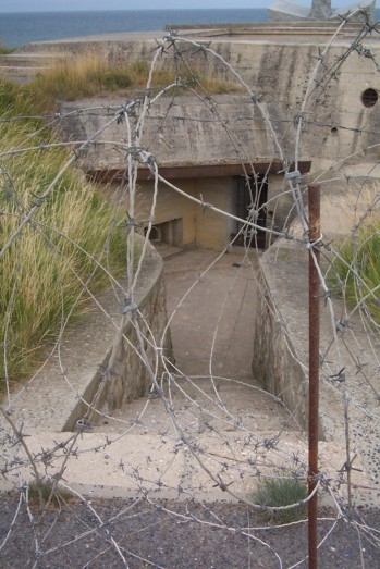
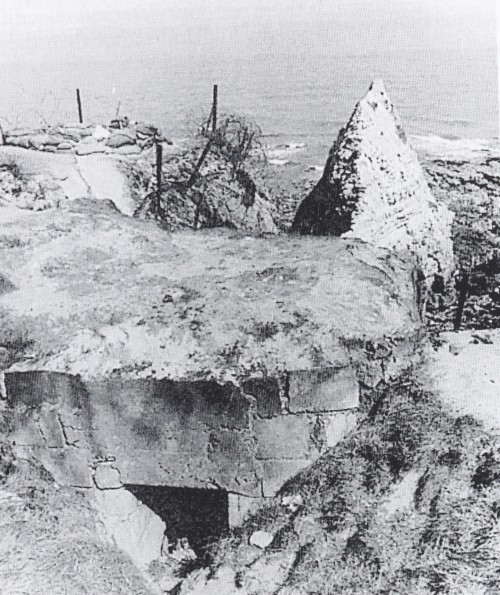
The main observation bunker (Hex OO13 on the PdH map). Eight German soldiers held out here after the Rangers landed and took the first part of Point du Hoc , a democharge forced the eight survivors to surrender.
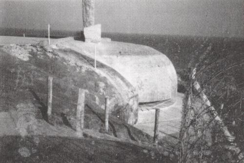
The main observation bunker (Hex OO13 on the PdH map) in 1944 before allied landings.
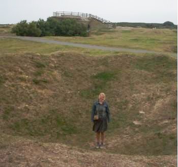
This picture shows really well the size of the craters left by allied naval and air bombardment - its almost twice as deep as my girlfriend is tall.
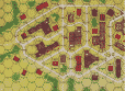
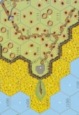
ASL Data
Module:
Point du Hoc (Critical Hit)
Map:
'PdH'
Scenario:
-19 Backs to the sea
-PdH1 Praise the lord
-PdH2 Road Wariors
-PdH3 Nowhere to run & hide
-PdH4 Longest night
-PdH5 Rangers Relief
-PdH CG
Geography
Name:
Point du Hoc
Place:
Point du Hoc
Normandy
France
(American soil after WO2)

|